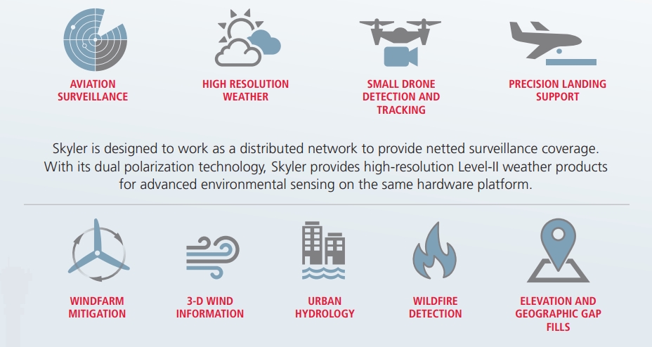
Skyler is a surveillance platform for multiple missions built on a foundation of Active Electronically Scanning Array (AESA) hardware. Most operational radars make complete scan every 5 or 6 minutes. This radar is providing data every few seconds.

Blog Archives
Raytheon Skyler Radar
Rotterdam Rain Radar
New video and an article about RainGain radar in Rotterdam
IEEE GRSS Webinar Series: Akira Hirose – Advanced Neural Adaptive Processing in Interferometric and Polarimetric Radar Imaging
In the first of a series of live webinars for the IEEE Geoscience & Remote Sensing Society (GRSS), IEEE.tv will broadcast a live presentation by Dr. Akira Hirose, a GRSS Distinguished Lecturer. This talk is being presented at the IEEE GRSS Taipei Chapter, and the live broadcast is generated courtesy of Taipei Tech in Taiwan.
Dr. Hirose will present his talk on “Advanced Neural Adaptive Processing in Interferometric and Polarimetric Radar Imaging” (abstract below).
ABSTRACT
This talk presents and discusses advanced neural networks by focusing on complex-valued neural networks (CVNNs) and their applications in the remote sensing and imaging fields. CVNNs are suitable for adaptive processing of complex-amplitude information. Since active remote sensing deals with coherent electromagnetic wave, we can expect CVNNs to work more effectively than conventional neural networks or other adaptive methods in real-number space. Quaternion (or Hypercomplex-valued) neural networks are also discussed in relation to polarization information processing.
The beginning half of the Talk is devoted to presentation of the basic idea, overall framework, and fundamental treatment in the CVNNs. We discuss the processing dynamics of Hebbian rule, back-propagation learning, and self-organizing map in the complex domain. The latter half shows some examples of CVNN processing in the geoscience and remote sensing society (GRSS) fields. Namely, we present distortion reduction in phase unwrapping to generate digital elevation model (DEM) from the data obtained by interferometric synthetic aperture radar (InSAR). In polarization SAR (PolSAR), we apply quaternion networks for adaptive classification. Another example is ground penetrating radar (GPR) to visualize underground objects to distinguish specific targets in high-clutter situation. Finally we discuss the prospect of the CVNNs in the GRSS fields.
BIOGRAPHY
Akira Hirose (F ’13) received the Ph.D. degree in electronic engineering from the University of Tokyo in 1991. In 1987, he joined the Research Center for Advanced Science and Technology (RCAST), the University of Tokyo, as a Research Associate. In 1991, he was appointed as an Instructor at the RCAST. From 1993 to 1995, on leave of absence from The University of Tokyo, he joined the Institute for Neuroinformatics, University of Bonn, Bonn, Germany. He is currently a Professor with the Department of Electrical Engineering and Information Systems, the University of Tokyo. The main fields of his research interests are wireless electronics and neural networks. In the fields, he published several books such as Complex-Valued Neural Networks, 2nd Edition (Springer 2012).
Dr. Hirose is a Fellow of the IEEE, Senior Member of the Institute of Electronics, Information and Communication Engineers (IEICE) and a member of the Japanese Neural Network Society (JNNS). He received several awards such as IEICE Electronics Society (ES) Outstanding Achievement Award (2014), IEEE Geoscience and Remote Sensing Society (GRSS) Distinguished Lecturer honor (2014), IGI Global’s Excellence in Research Journal Award (2011), IEEE/INNS WCCI-IJCNN Runner-up Best Paper Award (IEEE Computational Intelligence Society (CIS) 2010), Excellent Service Award (IEICE ES), 2008, on ES General Secretary), IEEE/INNS WCCI-IJCNN Best Session Presentation Award (IEEE, INNS 2006), Excellent Service Award (IEICE ES), 2006, on Electromagnetic Theory (EMT) Technical Group), ICONIP Best Paper Award (Asia-Pacific Neural Network Assembly (APNNA), 2004), Inamori Scholars Membership (Inamori foundation) (2000), and Outstanding Research Award (Research Foundation for Opto-science and Technology) (1998).
He served as the President of the JNNS (2013-2015), Vice President of the IEICE Electronics Society (2013-2015), Editor-in-Chief of the IEICE Transactions on Electronics (2011-2012), Associate Editor of journals such as the IEEE TRANSACTIONS ON NEURAL NETWORKS (2009-2011), IEEE GEOSCIENCE AND REMOTE SENSING NEWSLETTER (2009-2012), Chair of the Neurocomputing Technical Group in the IEICE, and General Chair of the 2013 Asia-Pacific Conference on Synthetic Aperture Radar (APSAR 2013) in Tsukuba. He currently serves as the a member of IEEE Computational Intelligence Society (CIS) Neural Networks Technical Committee (NNTC) (2009-), Founding Chair of the NNTC Complex-Valued Neural Network Task Force (2010-), Governing Board Member of the Asia-Pacific Neural Network Assembly (2006-), IEEE GRSS Tokyo Chapter Chair (2013-2015), Founding President of Asia-Pacific Neural Network Society (APNNS) newly starting in 2016, General Chair of International Conference on Neural Information Processing (ICONIP) 2016 Kyoto, and General Chair of International Geoscience and Remote Sensing Symposium (IGARSS) 2019 Yokohama.
Our visitors in February 2016
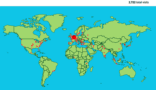
In February 2016 our web-site radar.tudelft.nl visited by 2722 people from the world…
Our visitors in January 2016
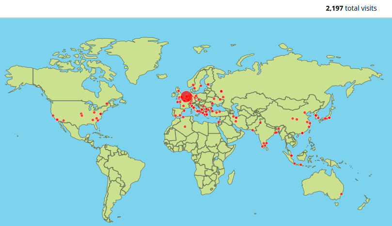
In January 2016 our web-site radar.tudelft.nl visited by 2197 people from whole world…
Our visitors…
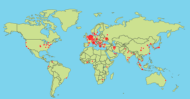
In November 2015 our web-site radar.ewi.tudelft.nl visited by 715 people from whole world…
TU Delft news: Rain Radar installed in Rotterdam
Should you go by bus or by bicycle? Take your umbrella or your sunglasses? A newly installed rain radar in Rotterdam may help, as it will be able to accurately chart and predict local precipitation. Main aim of the project is to prevent local flooding and water damage.
A new type of rain radar was installed in Rotterdam on 22 September. The radar was installed on the roof of the Delftse Poort office building on the Weena. It will be used to accurately chart the rain patterns in Rotterdam.
As high as possible
Unlike the existing radars that measure precipitation throughout the whole of the Netherlands, the recently installed rain radar specialises in measuring local precipitation. For optimum observation of precipitation in the city, the rain radar must be placed as high as possible above the city’s skyline. The radar was therefore placed on the roof of the Delftse Poort office building on the Weena – one of the tallest buildings in the city centre. The radar was hoisted up via the window cleaner’s lift to a height of 150 metres and fixed to a special frame on the roof in order to withstand strong wind gusts. The radar’s range is 30 kilometres and therefore covers the entire city and the surrounding area, including the Europoort.
Test phase
The radar will now be extensively tested. The rotation of the radar antennas requires very precise control to enable accurate measuring. Processing the radar signals – many terabytes of data – places high demands on data communication for which special fibre-optic connections have been laid running up to the roof. Following the test phase, the radar will officially become operational in mid-October.
RainGain
The Rotterdam rain radar forms part of the wide-ranging European RainGain project, a transnational project aimed at improving the prediction of pluvial floods in our cities. RainGain develops and tests innovative tools and practices based on the use of high resolution radars in four pilot cities: Leuven, London, Paris, and Rotterdam.
More information on the use of rain radars is provided in this interview with Marie-Claire ten Veldhuis (CiTG):
As you wish…
As decided on the group’s meeting, today we are starting these pages.


